Chapter-4: Create netCDF for time series data#
“Time Series” are data that are taken over a period of time for a single or multiple stations. Stations have unique identifiers. NetCDF files containing time series require the attribute featureType = timeSeries as a global attribute. As announced in Chapter 2, we will walk you through the procedure of creating a netCDF file for various types of time series data as suggested by the CF Conventions in this chapter.
The CF Conventions introduced the following representations for time series:
Single Timeseries (H.2.3): The file containes only one station and a single time series.
Orthogonal multidimensional array representation of time series (H.2.1): Multiple stations have the same number of time coordinates and the time values are identical, e.g. multiple weather stations measure at the same time, or the times are averaged to be the same. This representation can also be applied on multiple time series with different time coordinate values. However, there can be many missing values raised in the dataset; thus, we can consider using the next representation.
Incomplete multidimensional array representation of time series (H.2.2): Multiple stations have the same number of time coordinates, but time values are different. For such kind of data, this representation is more efficient in storage space usage compared to H.2.1.
Contiguous ragged array representation of time series (H.2.4): Multiple stations have different time series lengths, and the whole dataset is complete (no more new observations will be made). This representation could be harder to interpret, but it is efficient in saving storage space.
Indexed ragged array representation of time series (H.2.5): Multiple stations have differrent time series lengths, and the dataset is not complete (dataset will be updated when new measurements are made).
Note
Don’t be scared by the “terms” that describe the types; in fact, they can be easily recognized and distinguished based on the descriptions written in bold texts.
The H-number is the index of each data representation in the CF Conventions’ documentation.
For the showcase here, we used two datasets of Kelp Forest Monitoring Sea Temperature[4], “KFMTemperature_Anacapa_Black_Sea_Bass_Reef.nc.gz” and “KFMTemperature_Anacapa_East_Fish_Camp.nc.gz”, which can be downloaded from NOAA’s ERDDAP server.
Having the datasets ready, we are taking on the following practice:
Each dataset downloaded from the source above contains a single time series, yet not in the form as recommended in the CF Conventions. We will transform a single time series into the form as suggested in Appendix H.2.3.
We will modify the time coordinates of the station “black sea bass reef” by subtracting 2 minutes to match with the time coordinates of the station “east fish camp”. Then, we will subset both datasets to make them share common time coordinates. Then, we are merging both subsets into a single netCDF in the form as given in Appendix H.2.1 in the CF Conventions.
Starting again from Stage 1, we will subset both datasets to be the same length on time axis (time values aren’t identical), and merge the data into the form as given in Appendix H.2.2 in the CF Conventions.
In fact, the two datasets downloaded from the source above have different lengths at time axis, so we will merge them into the form as given in Appendix H.2.4 in the CF Conventions.
Assuming that the two downloaded time series aren’t yet complete, we will merge the data into a form that new elements, if any, can be written/attached to the existing netCDF in sequence (as given in Appendix H.2.5).
import os
from glob import glob
import numpy as np
import pandas as pd
import xarray as xr
import matplotlib.pyplot as plt
import cftime
# List available datasets. Please change it to your file path.
os.chdir('../src/data')
ts_files = sorted(glob(os.path.join(os.getcwd(), "dsg_timeSeries", "*.nc")))
1. Make Single Time Series compliant with the CF Conventions (H.2.3)#
# Read netCDF with xarray
ds_anacapa = xr.open_dataset(ts_files[0], decode_times=False)

print(ds_anacapa["ID"].data)
ds_anacapa
b'Anacapa (Black Sea Bass Reef)'
<xarray.Dataset> Size: 193kB
Dimensions:      (LON: 1, LAT: 1, DEPTH: 1, TIME: 16065)
Coordinates:
  * LON          (LON) float32 4B -119.4
  * LAT          (LAT) float32 4B 34.0
  * DEPTH        (DEPTH) int32 4B 17
  * TIME         (TIME) float64 129kB 1.13e+09 1.13e+09 ... 1.188e+09 1.188e+09
Data variables:
    Temperature  (TIME, DEPTH, LAT, LON) float32 64kB ...
    ID           |S29 29B b'Anacapa (Black Sea Bass Reef)'
Attributes: (12/38)
    acknowledgement:               NOAA NESDIS COASTWATCH, NOAA SWFSC ERD
    cdm_data_type:                 Station
    contributor_name:              Channel Islands National Park, National Pa...
    contributor_role:              Source of data.
    Conventions:                   COARDS, CF-1.0, Unidata Observation Datase...
    creator_email:                 Roy.Mendelssohn@noaa.gov
    ...                            ...
    standard_name_vocabulary:      CF-1.0
    summary:                       The subtidal temperature data taken at Cha...
    time_coverage_end:             2007-08-21T00:42:00Z
    time_coverage_start:           2005-10-20T17:32:00Z
    title:                         Sea Temperature (Kelp Forest Monitoring, C...
Westernmost_Easting: -119.38333# Original shape of the "Temperature" data
print(ds_anacapa.Temperature.shape)
# Length of the original "Temperature" data array
print(len(ds_anacapa.Temperature))
# Reshape it as a one-dimensional array, using numpy.ndarray.reshape
temp = ds_anacapa.Temperature.data.reshape([len(ds_anacapa.Temperature)])
temp
(16065, 1, 1, 1)
16065
array([16.66, 16.5 , 16.5 , ..., 18.21, 18.21, 18.21], dtype=float32)
# Get the data values of latitude, longitude and depth
lat = ds_anacapa.LAT.data[0]
lon = ds_anacapa.LON.data[0]
depth = ds_anacapa.DEPTH.data[0]

print(lat, lon, depth)
34.0 -119.38333 17
# Get Variable Attributes
attr_lat = ds_anacapa.LAT.attrs
attr_lon = ds_anacapa.LON.attrs
attr_depth = ds_anacapa.DEPTH.attrs
attr_temp = ds_anacapa.Temperature.attrs

attr_lat
{'_CoordinateAxisType': 'Lat',
 'actual_range': array([34., 34.], dtype=float32),
 'axis': 'Y',
 'long_name': 'Latitude',
 'standard_name': 'latitude',
 'units': 'degrees_north'}
# Drop unneeded dimensions, rename dimension and coordinate variable of time
ds_anacapa = ds_anacapa.drop_dims(["LON", "LAT", "DEPTH"]).rename({"TIME":"time", "ID":"station_name"})
ds_anacapa
<xarray.Dataset> Size: 129kB
Dimensions:       (time: 16065)
Coordinates:
  * time          (time) float64 129kB 1.13e+09 1.13e+09 ... 1.188e+09 1.188e+09
Data variables:
    station_name  |S29 29B b'Anacapa (Black Sea Bass Reef)'
Attributes: (12/38)
    acknowledgement:               NOAA NESDIS COASTWATCH, NOAA SWFSC ERD
    cdm_data_type:                 Station
    contributor_name:              Channel Islands National Park, National Pa...
    contributor_role:              Source of data.
    Conventions:                   COARDS, CF-1.0, Unidata Observation Datase...
    creator_email:                 Roy.Mendelssohn@noaa.gov
    ...                            ...
    standard_name_vocabulary:      CF-1.0
    summary:                       The subtidal temperature data taken at Cha...
    time_coverage_end:             2007-08-21T00:42:00Z
    time_coverage_start:           2005-10-20T17:32:00Z
    title:                         Sea Temperature (Kelp Forest Monitoring, C...
Westernmost_Easting: -119.38333Note
xarray.Dataset.rename() will change the name of both the dimension and the coordinate variable, while xarray.Dataset.rename_dims() only changes the name of the dimension and leaves the coordinate variable name unchanged.
# Recompose the Dataset
ds_anacapa = ds_anacapa.assign_coords(lat = ([], np.float32(lat), attr_lat),
                                     lon = ([], np.float32(lon), attr_lon),
                                     depth = ([], np.int32(depth), attr_depth))

ds_anacapa = ds_anacapa.assign(temperature = (['time'], np.float32(temp), attr_temp))

ds_anacapa
<xarray.Dataset> Size: 193kB
Dimensions:       (time: 16065)
Coordinates:
  * time          (time) float64 129kB 1.13e+09 1.13e+09 ... 1.188e+09 1.188e+09
    lat           float32 4B 34.0
    lon           float32 4B -119.4
    depth         int32 4B 17
Data variables:
    station_name  |S29 29B b'Anacapa (Black Sea Bass Reef)'
    temperature   (time) float32 64kB 16.66 16.5 16.5 ... 18.21 18.21 18.21
Attributes: (12/38)
    acknowledgement:               NOAA NESDIS COASTWATCH, NOAA SWFSC ERD
    cdm_data_type:                 Station
    contributor_name:              Channel Islands National Park, National Pa...
    contributor_role:              Source of data.
    Conventions:                   COARDS, CF-1.0, Unidata Observation Datase...
    creator_email:                 Roy.Mendelssohn@noaa.gov
    ...                            ...
    standard_name_vocabulary:      CF-1.0
    summary:                       The subtidal temperature data taken at Cha...
    time_coverage_end:             2007-08-21T00:42:00Z
    time_coverage_start:           2005-10-20T17:32:00Z
    title:                         Sea Temperature (Kelp Forest Monitoring, C...
Westernmost_Easting: -119.38333Note
xarray.Dataset.assign_coords will add new coordinate variables to the dataset, and xarray.Dataset.assign will add new data variables to the dataset. In this example, latitude, longitude, and depth function like auxiliary coordinate variable, so they’re added as coordinates.
# Add auxiliary coordinate variables as in "coordinates" attribute
ds_anacapa['temperature'].attrs['coordinates'] = "lat lon depth station_name"

# Add cf_role to station name
ds_anacapa.station_name.attrs['cf_role'] = "timeseries_id"

# Add feature type in to global attribute
ds_anacapa.attrs['feature_type'] = "timeSeries"

ds_anacapa.info()
xarray.Dataset {
dimensions:
	time = 16065 ;

variables:
	float64 time(time) ;
		time:_CoordinateAxisType = Time ;
		time:actual_range = [1.12982952e+09 1.18765692e+09] ;
		time:axis = T ;
		time:long_name = Time ;
		time:standard_name = time ;
		time:time_origin = 01-JAN-1970 00:00:00 ;
		time:units = seconds since 1970-01-01T00:00:00Z ;
	|S29 station_name() ;
		station_name:long_name = Station Identifier ;
		station_name:units = unitless ;
		station_name:cf_role = timeseries_id ;
	float32 lat() ;
		lat:_CoordinateAxisType = Lat ;
		lat:actual_range = [34. 34.] ;
		lat:axis = Y ;
		lat:long_name = Latitude ;
		lat:standard_name = latitude ;
		lat:units = degrees_north ;
	float32 lon() ;
		lon:_CoordinateAxisType = Lon ;
		lon:actual_range = [-119.38333 -119.38333] ;
		lon:axis = X ;
		lon:long_name = Longitude ;
		lon:standard_name = longitude ;
		lon:units = degrees_east ;
	int32 depth() ;
		depth:_CoordinateAxisType = Height ;
		depth:_CoordinateZisPositive = down ;
		depth:actual_range = [17 17] ;
		depth:axis = Z ;
		depth:long_name = Depth ;
		depth:positive = down ;
		depth:standard_name = depth ;
		depth:units = m ;
	float32 temperature(time) ;
		temperature:actual_range = [10.91 22.34] ;
		temperature:long_name = Sea Temperature ;
		temperature:standard_name = sea_water_temperature ;
		temperature:units = degree_C ;
		temperature:coordinates = lat lon depth station_name ;

// global attributes:
	:acknowledgement = NOAA NESDIS COASTWATCH, NOAA SWFSC ERD ;
	:cdm_data_type = Station ;
	:contributor_name = Channel Islands National Park, National Park Service ;
	:contributor_role = Source of data. ;
	:Conventions = COARDS, CF-1.0, Unidata Observation Dataset v1.0 ;
	:creator_email = Roy.Mendelssohn@noaa.gov ;
	:creator_name = NOAA NMFS SWFSC ERD ;
	:creator_url = http://www.pfel.noaa.gov ;
	:date_created = 2008-06-11T21:42:43Z ;
	:date_issued = 2008-06-11T21:42:43Z ;
	:Easternmost_Easting = -119.38333129882812 ;
	:geospatial_lat_max = 34.0 ;
	:geospatial_lat_min = 34.0 ;
	:geospatial_lat_units = degrees_north ;
	:geospatial_lon_max = -119.38333129882812 ;
	:geospatial_lon_min = -119.38333129882812 ;
	:geospatial_lon_units = degrees_east ;
	:geospatial_vertical_max = 17 ;
	:geospatial_vertical_min = 17 ;
	:geospatial_vertical_positive = down ;
	:geospatial_vertical_units = m ;
	:history = Channel Islands National Park, National Park Service
2008-06-11T21:42:43Z NOAA CoastWatch (West Coast Node) and NOAA SFSC ERD ;
	:id = KFMTemperature_Anacapa_Black_Sea_Bass_Reef ;
	:institution = NOAA NMFS SWFSC ERD ;
	:keywords = EARTH SCIENCE > Oceans > Ocean Temperature > Water Temperature ;
	:keywords_vocabulary = GCMD Science Keywords ;
	:license = The data may be used and redistributed for free but is not intended for legal use, since it may contain inaccuracies. Neither the data Contributor, CoastWatch, NOAA, nor the United States Government, nor any of their employees or contractors, makes any warranty, express or implied, including warranties of merchantability and fitness for a particular purpose, or assumes any legal liability for the accuracy, completeness, or usefulness, of this information.  National Park Service Disclaimer: The National Park Service shall not be held liable for improper or incorrect use of the data described and/or contained herein. These data and related graphics are not legal documents and are not intended to be used as such. The information contained in these data is dynamic and may change over time. The data are not better than the original sources from which they were derived. It is the responsibility of the data user to use the data appropriately and consistent within the limitation of geospatial data in general and these data in particular. The related graphics are intended to aid the data user in acquiring relevant data; it is not appropriate to use the related graphics as data. The National Park Service gives no warranty, expressed or implied, as to the accuracy, reliability, or completeness of these data. It is strongly recommended that these data are directly acquired from an NPS server and not indirectly through other sources which may have changed the data in some way. Although these data have been processed successfully on computer systems at the National Park Service, no warranty expressed or implied is made regarding the utility of the data on other systems for general or scientific purposes, nor shall the act of distribution constitute any such warranty. This disclaimer applies both to individual use of the data and aggregate use with other data. ;
	:naming_authority = gov.noaa.pfel.coastwatch ;
	:Northernmost_Northing = 34.0 ;
	:project = NOAA NMFS SWFSC ERD (http://www.pfel.noaa.gov/) ;
	:references = Channel Islands National Parks Inventory and Monitoring information: http://nature.nps.gov/im/units/medn . Kelp Forest Monitoring Protocols: http://www.nature.nps.gov/im/units/chis/Reports_PDF/Marine/KFM-HandbookVol1.pdf . ;
	:Southernmost_Northing = 34.0 ;
	:standard_name_vocabulary = CF-1.0 ;
	:summary = The subtidal temperature data taken at Channel Islands National Parks' Kelp Forest Monitoring Programs permanent monitoring sites.  Since 1993, remote temperature loggers manufactured by Onset Computer Corporation were deployed at each site approximately 10-20 cm from the bottom in a underwater housing.  Since 1993, three models of temperature loggers (HoboTemp (tm), StowAway (R) and Tidbit(R) )were used to collect temperature data every 1-5 hours depending on the model used. ;
	:time_coverage_end = 2007-08-21T00:42:00Z ;
	:time_coverage_start = 2005-10-20T17:32:00Z ;
	:title = Sea Temperature (Kelp Forest Monitoring, Channel Islands) ;
	:Westernmost_Easting = -119.38333129882812 ;
	:feature_type = timeSeries ;
}
Note
According to the CF conventions, “where feasible a variable with the attribute cf_role should be included. The only acceptable values of cf_role for DGS are “timeseries_id”, “profile_id” and “trajectory_id”. The variable carrying the cf_role attribute may have any data type. When a variable is assigned this attribute, it must provide a unique identifier for each feature instance”.
2. Orthogonal multidimensional array representation of time series (H.2.1)#
Multiple stations, time series of same length, time values are the same.
Can also be used even if time values are different, but NA values are included, storage space inefficient.
# Observing the Dataset
ds_anacapa1 = xr.open_dataset(ts_files[0], decode_times=True)
ds_anacapa2 = xr.open_dataset(ts_files[1], decode_times=True)
print(ds_anacapa1.ID.data, ds_anacapa2.ID.data)
print(ds_anacapa1.TIME.data[:10])
print(ds_anacapa2.TIME.data[:10])
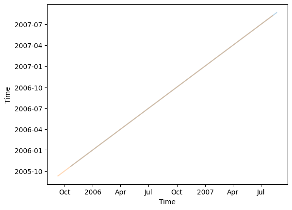
print(ds_anacapa1.TIME.plot(alpha=0.3))
print(ds_anacapa2.TIME.plot(alpha=0.3))
b'Anacapa (Black Sea Bass Reef)' b'Anacapa (East Fish Camp)'
['2005-10-20T17:32:00.000000000' '2005-10-20T18:32:00.000000000'
 '2005-10-20T19:32:00.000000000' '2005-10-20T20:32:00.000000000'
 '2005-10-20T21:32:00.000000000' '2005-10-20T22:32:00.000000000'
 '2005-10-20T23:32:00.000000000' '2005-10-21T00:32:00.000000000'
 '2005-10-21T01:32:00.000000000' '2005-10-21T02:32:00.000000000']
['2005-09-09T18:30:00.000000000' '2005-09-09T19:30:00.000000000'
 '2005-09-09T20:30:00.000000000' '2005-09-09T21:30:00.000000000'
 '2005-09-09T22:30:00.000000000' '2005-09-09T23:30:00.000000000'
 '2005-09-10T00:30:00.000000000' '2005-09-10T01:30:00.000000000'
 '2005-09-10T02:30:00.000000000' '2005-09-10T03:30:00.000000000']
[<matplotlib.lines.Line2D object at 0x285802690>]
[<matplotlib.lines.Line2D object at 0x285842e10>]
# Read Datasets, don't decode times
ds_anacapa1 = xr.open_dataset(ts_files[0], decode_times=False)
ds_anacapa2 = xr.open_dataset(ts_files[1], decode_times=False)
print("All time values at station 'Black Sea Bass Reef' subtracted by two minutes: ", "\n",
      cftime.num2date(times = ds_anacapa1.TIME.data - 120,
                units = "seconds since 1970-01-01T00:00:00Z"))

# Round the time values of Black Sea Bass Reef to match the time values of East Fish Camp
ds_anacapa1.TIME.data[:] = ds_anacapa1.TIME.data[:] - 120
All time values at station 'Black Sea Bass Reef' subtracted by two minutes:
 [cftime.DatetimeGregorian(2005, 10, 20, 17, 30, 0, 0, has_year_zero=False)
 cftime.DatetimeGregorian(2005, 10, 20, 18, 30, 0, 0, has_year_zero=False)
 cftime.DatetimeGregorian(2005, 10, 20, 19, 30, 0, 0, has_year_zero=False)
 ...
 cftime.DatetimeGregorian(2007, 8, 20, 22, 40, 0, 0, has_year_zero=False)
 cftime.DatetimeGregorian(2007, 8, 20, 23, 40, 0, 0, has_year_zero=False)
 cftime.DatetimeGregorian(2007, 8, 21, 0, 40, 0, 0, has_year_zero=False)]
# Find common time values of both time series
time = np.intersect1d(ds_anacapa1.TIME.data, ds_anacapa2.TIME.data)
print("Number of common time values in both time series: ", len(time))
Number of common time values in both time series: 5568
# Subset both datasets by common time coordinates
ds_anacapa1 = ds_anacapa1.sel(TIME = time)
ds_anacapa2 = ds_anacapa2.sel(TIME = time)

print("Dimension of two datasets with common time coordinates: ", "\n",
      ds_anacapa1.dims, "\n", ds_anacapa2.dims)
Dimension of two datasets with common time coordinates:
 FrozenMappingWarningOnValuesAccess({'LON': 1, 'LAT': 1, 'DEPTH': 1, 'TIME': 5568})
 FrozenMappingWarningOnValuesAccess({'LON': 1, 'LAT': 1, 'DEPTH': 1, 'TIME': 5568})
# Longitudes of two stations
lon = [ds_anacapa1.LON.data[0], ds_anacapa2.LON.data[0]]
print("Longitudes of two stations: ", lon)

# Latitudes of two stations
lat = [ds_anacapa1.LAT.data[0], ds_anacapa2.LAT.data[0]]
print("Latitudes of two stations: ", lat)

# Depth of two stations
depth = [ds_anacapa1.DEPTH.data[0], ds_anacapa2.DEPTH.data[0]]
print("Depth of two stations: ", depth)

# Names of two stations
station_name = [ds_anacapa1.ID.data.astype("str").item(),
                ds_anacapa2.ID.data.astype("str").item()]
print("Names of two stations: ", station_name)
Longitudes of two stations:  [-119.38333, -119.38333]
Latitudes of two stations:  [34.0, 34.0]
Depth of two stations:  [17, 11]
Names of two stations:  ['Anacapa (Black Sea Bass Reef)', 'Anacapa (East Fish Camp)']
# Extract data of Temperature values;
# it should be composed as a 2D array of dimension (station, time); in this example of dimension (2, 5568)
temp = np.row_stack((ds_anacapa1.Temperature.data.reshape([len(ds_anacapa1.Temperature.data)]),
                    ds_anacapa2.Temperature.data.reshape([len(ds_anacapa2.Temperature.data)])))
temp
array([[16.66, 16.5 , 16.5 , ..., 13.21, 12.74, 12.74],
       [14.99, 14.21, 13.59, ..., 17.2 , 17.2 , 17.2 ]], dtype=float32)
# Extract Variable Attributes
attr_lat = ds_anacapa1.LAT.attrs
attr_lon = ds_anacapa1.LON.attrs
attr_depth = ds_anacapa1.DEPTH.attrs
attr_time = ds_anacapa1.TIME.attrs
attr_temp = ds_anacapa1.Temperature.attrs
ds_anacapa = xr.Dataset(
    coords = {
        "time": (["time"], time, attr_time),
        "lat": (["station"], lat, attr_lat),
        "lon": (["station"], lon, attr_lon),
        "depth": (["station"], depth, attr_depth),
        "station_name": (["station"], station_name, {"long_name": "station name",
                                                     "cf_role": "timeseries_id"})
    },
    data_vars = {
        "temperature": (["station", "time"], temp, attr_temp)
    }
)
ds_anacapa
<xarray.Dataset> Size: 89kB
Dimensions:       (station: 2, time: 5568)
Coordinates:
  * time          (time) float64 45kB 1.13e+09 1.13e+09 ... 1.15e+09 1.15e+09
    lat           (station) float32 8B 34.0 34.0
    lon           (station) float32 8B -119.4 -119.4
    depth         (station) int32 8B 17 11
    station_name  (station) <U29 232B 'Anacapa (Black Sea Bass Reef)' 'Anacap...
Dimensions without coordinates: station
Data variables:
temperature (station, time) float32 45kB 16.66 16.5 16.5 ... 17.2 17.2# Add additional variable attributes
ds_anacapa.temperature.attrs['coordinates'] = "lat lon depth station_name"
# Update Specific Variable Attributes
range_lon = [ds_anacapa.lon.data.min(), ds_anacapa.lon.data.max()]
range_lat = [ds_anacapa.lat.data.min(), ds_anacapa.lat.data.max()]
range_depth = [ds_anacapa.depth.data.min(), ds_anacapa.depth.data.max()]
range_time = [ds_anacapa.time.data.min(), ds_anacapa.time.data.max()]
range_temp = [ds_anacapa.temperature.data.min(), ds_anacapa.temperature.data.max()]
ds_anacapa.lon.attrs['actual_range'] = range_lon
ds_anacapa.lat.attrs['actual_range'] = range_lat
ds_anacapa.depth.attrs['actual_range'] = range_depth
ds_anacapa.time.attrs['actual_range'] = range_time
ds_anacapa.temperature.attrs['actual_range'] = range_temp
# Add Global Attribute
ds_anacapa.attrs['featureType'] = "timeSeries"
ds_anacapa.info()
xarray.Dataset {
dimensions:
	station = 2 ;
	time = 5568 ;

variables:
	float32 temperature(station, time) ;
		temperature:actual_range = [10.65, 18.48] ;
		temperature:long_name = Sea Temperature ;
		temperature:standard_name = sea_water_temperature ;
		temperature:units = degree_C ;
		temperature:coordinates = lat lon depth station_name ;
	float64 time(time) ;
		time:_CoordinateAxisType = Time ;
		time:actual_range = [1129829400.0, 1149870600.0] ;
		time:axis = T ;
		time:long_name = Time ;
		time:standard_name = time ;
		time:time_origin = 01-JAN-1970 00:00:00 ;
		time:units = seconds since 1970-01-01T00:00:00Z ;
	float32 lat(station) ;
		lat:_CoordinateAxisType = Lat ;
		lat:actual_range = [34.0, 34.0] ;
		lat:axis = Y ;
		lat:long_name = Latitude ;
		lat:standard_name = latitude ;
		lat:units = degrees_north ;
	float32 lon(station) ;
		lon:_CoordinateAxisType = Lon ;
		lon:actual_range = [-119.38333, -119.38333] ;
		lon:axis = X ;
		lon:long_name = Longitude ;
		lon:standard_name = longitude ;
		lon:units = degrees_east ;
	int32 depth(station) ;
		depth:_CoordinateAxisType = Height ;
		depth:_CoordinateZisPositive = down ;
		depth:actual_range = [11, 17] ;
		depth:axis = Z ;
		depth:long_name = Depth ;
		depth:positive = down ;
		depth:standard_name = depth ;
		depth:units = m ;
	<U29 station_name(station) ;
		station_name:long_name = station name ;
		station_name:cf_role = timeseries_id ;

// global attributes:
	:featureType = timeSeries ;
}
3. Incomplete multidimensional array representation of time series (H.2.2)#
Multiple stations, time series of same length but have different time values
Technically, it’s also possible to use this template for time series with different length. You can refer to another exercise in the Gitlab repository for this case.
ds_anacapa1 = xr.open_dataset(ts_files[0], decode_times=False)
ds_anacapa2 = xr.open_dataset(ts_files[1], decode_times=False)
print(ds_anacapa1.ID.data, ds_anacapa2.ID.data)

ds_anacapa2
b'Anacapa (Black Sea Bass Reef)' b'Anacapa (East Fish Camp)'
<xarray.Dataset> Size: 201kB
Dimensions:      (LON: 1, LAT: 1, DEPTH: 1, TIME: 16733)
Coordinates:
  * LON          (LON) float32 4B -119.4
  * LAT          (LAT) float32 4B 34.0
  * DEPTH        (DEPTH) int32 4B 11
  * TIME         (TIME) float64 134kB 1.126e+09 1.126e+09 ... 1.187e+09
Data variables:
    Temperature  (TIME, DEPTH, LAT, LON) float32 67kB ...
    ID           |S24 24B b'Anacapa (East Fish Camp)'
Attributes: (12/38)
    acknowledgement:               NOAA NESDIS COASTWATCH, NOAA SWFSC ERD
    cdm_data_type:                 Station
    contributor_name:              Channel Islands National Park, National Pa...
    contributor_role:              Source of data.
    Conventions:                   COARDS, CF-1.0, Unidata Observation Datase...
    creator_email:                 Roy.Mendelssohn@noaa.gov
    ...                            ...
    standard_name_vocabulary:      CF-1.0
    summary:                       The subtidal temperature data taken at Cha...
    time_coverage_end:             2007-08-07T21:38:00Z
    time_coverage_start:           2005-09-09T18:30:00Z
    title:                         Sea Temperature (Kelp Forest Monitoring, C...
Westernmost_Easting: -119.38333# Subset both datasets to be same length / Select same amount of observation from both datasets
ds_anacapa1 = ds_anacapa1.isel(TIME = slice(None, 50))
ds_anacapa2 = ds_anacapa2.isel(TIME = slice(-50, None))
print("Dimensions of the data subset 1: ", ds_anacapa1.dims)
print("Dimensions of the data subset 2: ", ds_anacapa2.dims)
Dimensions of the data subset 1:  FrozenMappingWarningOnValuesAccess({'LON': 1, 'LAT': 1, 'DEPTH': 1, 'TIME': 50})
Dimensions of the data subset 2:  FrozenMappingWarningOnValuesAccess({'LON': 1, 'LAT': 1, 'DEPTH': 1, 'TIME': 50})
# Longitudes of two stations
lon = [ds_anacapa1.LON.data[0], ds_anacapa2.LON.data[0]]
print("Longitudes of two stations: ", lon)

# Latitudes of two stations
lat = [ds_anacapa1.LAT.data[0], ds_anacapa2.LAT.data[0]]
print("Latitudes of two stations: ", lat)

# Depth of two stations
depth = [ds_anacapa1.DEPTH.data[0], ds_anacapa2.DEPTH.data[0]]
print("Depth of two stations: ", depth)

# Names of two stations
station_name = [ds_anacapa1.ID.data.astype("str").item(),
                ds_anacapa2.ID.data.astype("str").item()]
print("Names of two stations: ", station_name)
Longitudes of two stations:  [-119.38333, -119.38333]
Latitudes of two stations:  [34.0, 34.0]
Depth of two stations:  [17, 11]
Names of two stations:  ['Anacapa (Black Sea Bass Reef)', 'Anacapa (East Fish Camp)']
# "time" is a two-dimensional array of (station, obs), in this case (2, 50)
# Create a 2D array from two 1D arrays
time = np.row_stack((ds_anacapa1.TIME.data, ds_anacapa2.TIME.data))

print(time)
print("Array shape of the time coordinates:", time.shape)
[[1.12982952e+09 1.12983312e+09 1.12983672e+09 1.12984032e+09
  1.12984392e+09 1.12984752e+09 1.12985112e+09 1.12985472e+09
  1.12985832e+09 1.12986192e+09 1.12986552e+09 1.12986912e+09
  1.12987272e+09 1.12987632e+09 1.12987992e+09 1.12988352e+09
  1.12988712e+09 1.12989072e+09 1.12989432e+09 1.12989792e+09
  1.12990152e+09 1.12990512e+09 1.12990872e+09 1.12991232e+09
  1.12991592e+09 1.12991952e+09 1.12992312e+09 1.12992672e+09
  1.12993032e+09 1.12993392e+09 1.12993752e+09 1.12994112e+09
  1.12994472e+09 1.12994832e+09 1.12995192e+09 1.12995552e+09
  1.12995912e+09 1.12996272e+09 1.12996632e+09 1.12996992e+09
  1.12997352e+09 1.12997712e+09 1.12998072e+09 1.12998432e+09
  1.12998792e+09 1.12999152e+09 1.12999512e+09 1.12999872e+09
  1.13000232e+09 1.13000592e+09]
 [1.18634628e+09 1.18634988e+09 1.18635348e+09 1.18635708e+09
  1.18636068e+09 1.18636428e+09 1.18636788e+09 1.18637148e+09
  1.18637508e+09 1.18637868e+09 1.18638228e+09 1.18638588e+09
  1.18638948e+09 1.18639308e+09 1.18639668e+09 1.18640028e+09
  1.18640388e+09 1.18640748e+09 1.18641108e+09 1.18641468e+09
  1.18641828e+09 1.18642188e+09 1.18642548e+09 1.18642908e+09
  1.18643268e+09 1.18643628e+09 1.18643988e+09 1.18644348e+09
  1.18644708e+09 1.18645068e+09 1.18645428e+09 1.18645788e+09
  1.18646148e+09 1.18646508e+09 1.18646868e+09 1.18647228e+09
  1.18647588e+09 1.18647948e+09 1.18648308e+09 1.18648668e+09
  1.18649028e+09 1.18649388e+09 1.18649748e+09 1.18650108e+09
  1.18650468e+09 1.18650828e+09 1.18651188e+09 1.18651548e+09
  1.18651908e+09 1.18652268e+09]]
Array shape of the time coordinates: (2, 50)
# Data Variable "Temperature" will be a 2D array of shape (station, obs), in this example (2, 50)
temp = np.row_stack((ds_anacapa1.Temperature.data.reshape([len(ds_anacapa1.Temperature)]),
                     ds_anacapa2.Temperature.data.reshape([len(ds_anacapa2.Temperature)])))
print("Array shape of the temperature variable: ", temp.shape)
Array shape of the temperature variable: (2, 50)
# Extract Variable Attributes
attr_lat = ds_anacapa1.LAT.attrs
attr_lon = ds_anacapa1.LON.attrs
attr_depth = ds_anacapa1.DEPTH.attrs
attr_time = ds_anacapa1.TIME.attrs
attr_temp = ds_anacapa1.Temperature.attrs
# Restructure the data
ds_anacapa = xr.Dataset(
    coords = {
        "lat": (["station"], lat, attr_lat),
        "lon": (["station"], lon, attr_lon),
        "depth": (["station"], depth, attr_depth),
        "station_name": (["station"], station_name, {"long_name":"station name",
                                                     "cf_role": "timeseries_id"}),
        "time": (["station","obs"], time, attr_time)
    },
    data_vars = {
        "temperature": (["station","obs"], temp, attr_temp)
    }
)

ds_anacapa
<xarray.Dataset> Size: 1kB
Dimensions:       (station: 2, obs: 50)
Coordinates:
    lat           (station) float32 8B 34.0 34.0
    lon           (station) float32 8B -119.4 -119.4
    depth         (station) int32 8B 17 11
    station_name  (station) <U29 232B 'Anacapa (Black Sea Bass Reef)' 'Anacap...
    time          (station, obs) float64 800B 1.13e+09 1.13e+09 ... 1.187e+09
Dimensions without coordinates: station, obs
Data variables:
temperature (station, obs) float32 400B 16.66 16.5 16.5 ... 18.09 18.74# Add Additional Variable Attributes
ds_anacapa.time.attrs['coordinates'] = "time lat lon depth station_name"
# Update Specific Variable Attributes
range_lon = [ds_anacapa.lon.data.min(), ds_anacapa.lon.data.max()]
range_lat = [ds_anacapa.lat.data.min(), ds_anacapa.lat.data.max()]
range_depth = [ds_anacapa.depth.data.min(), ds_anacapa.depth.data.max()]
range_time = [ds_anacapa.time.data.min(), ds_anacapa.time.data.max()]
range_temp = [ds_anacapa.temperature.data.min(), ds_anacapa.temperature.data.max()]
ds_anacapa.lon.attrs['actual_range'] = range_lon
ds_anacapa.lat.attrs['actual_range'] = range_lat
ds_anacapa.depth.attrs['actual_range'] = range_depth
ds_anacapa.time.attrs['actual_range'] = range_time
ds_anacapa.temperature.attrs['actual_range'] = range_temp
# Add Global Attribute
ds_anacapa.attrs['featureType'] = "timeSeries"
ds_anacapa.info()
xarray.Dataset {
dimensions:
station = 2 ;
obs = 50 ;
variables:
float32 temperature(station, obs) ;
temperature:actual_range = [14.75, 20.21] ;
temperature:long_name = Sea Temperature ;
temperature:standard_name = sea_water_temperature ;
temperature:units = degree_C ;
float32 lat(station) ;
lat:_CoordinateAxisType = Lat ;
lat:actual_range = [34.0, 34.0] ;
lat:axis = Y ;
lat:long_name = Latitude ;
lat:standard_name = latitude ;
lat:units = degrees_north ;
float32 lon(station) ;
lon:_CoordinateAxisType = Lon ;
lon:actual_range = [-119.38333, -119.38333] ;
lon:axis = X ;
lon:long_name = Longitude ;
lon:standard_name = longitude ;
lon:units = degrees_east ;
int32 depth(station) ;
depth:_CoordinateAxisType = Height ;
depth:_CoordinateZisPositive = down ;
depth:actual_range = [11, 17] ;
depth:axis = Z ;
depth:long_name = Depth ;
depth:positive = down ;
depth:standard_name = depth ;
depth:units = m ;
<U29 station_name(station) ;
station_name:long_name = station name ;
station_name:cf_role = timeseries_id ;
float64 time(station, obs) ;
time:_CoordinateAxisType = Time ;
time:actual_range = [1129829520.0, 1186522680.0] ;
time:axis = T ;
time:long_name = Time ;
time:standard_name = time ;
time:time_origin = 01-JAN-1970 00:00:00 ;
time:units = seconds since 1970-01-01T00:00:00Z ;
time:coordinates = time lat lon depth station_name ;
// global attributes:
:featureType = timeSeries ;
}
ds_anacapa.time
<xarray.DataArray 'time' (station: 2, obs: 50)> Size: 800B
array([[1.12982952e+09, 1.12983312e+09, 1.12983672e+09, 1.12984032e+09,
        1.12984392e+09, 1.12984752e+09, 1.12985112e+09, 1.12985472e+09,
        1.12985832e+09, 1.12986192e+09, 1.12986552e+09, 1.12986912e+09,
        1.12987272e+09, 1.12987632e+09, 1.12987992e+09, 1.12988352e+09,
        1.12988712e+09, 1.12989072e+09, 1.12989432e+09, 1.12989792e+09,
        1.12990152e+09, 1.12990512e+09, 1.12990872e+09, 1.12991232e+09,
        1.12991592e+09, 1.12991952e+09, 1.12992312e+09, 1.12992672e+09,
        1.12993032e+09, 1.12993392e+09, 1.12993752e+09, 1.12994112e+09,
        1.12994472e+09, 1.12994832e+09, 1.12995192e+09, 1.12995552e+09,
        1.12995912e+09, 1.12996272e+09, 1.12996632e+09, 1.12996992e+09,
        1.12997352e+09, 1.12997712e+09, 1.12998072e+09, 1.12998432e+09,
        1.12998792e+09, 1.12999152e+09, 1.12999512e+09, 1.12999872e+09,
        1.13000232e+09, 1.13000592e+09],
       [1.18634628e+09, 1.18634988e+09, 1.18635348e+09, 1.18635708e+09,
        1.18636068e+09, 1.18636428e+09, 1.18636788e+09, 1.18637148e+09,
        1.18637508e+09, 1.18637868e+09, 1.18638228e+09, 1.18638588e+09,
        1.18638948e+09, 1.18639308e+09, 1.18639668e+09, 1.18640028e+09,
        1.18640388e+09, 1.18640748e+09, 1.18641108e+09, 1.18641468e+09,
        1.18641828e+09, 1.18642188e+09, 1.18642548e+09, 1.18642908e+09,
        1.18643268e+09, 1.18643628e+09, 1.18643988e+09, 1.18644348e+09,
        1.18644708e+09, 1.18645068e+09, 1.18645428e+09, 1.18645788e+09,
        1.18646148e+09, 1.18646508e+09, 1.18646868e+09, 1.18647228e+09,
        1.18647588e+09, 1.18647948e+09, 1.18648308e+09, 1.18648668e+09,
        1.18649028e+09, 1.18649388e+09, 1.18649748e+09, 1.18650108e+09,
        1.18650468e+09, 1.18650828e+09, 1.18651188e+09, 1.18651548e+09,
        1.18651908e+09, 1.18652268e+09]])
Coordinates:
lat (station) float32 8B 34.0 34.0
lon (station) float32 8B -119.4 -119.4
depth (station) int32 8B 17 11
station_name (station) <U29 232B 'Anacapa (Black Sea Bass Reef)' 'Anacap...
time (station, obs) float64 800B 1.13e+09 1.13e+09 ... 1.187e+09
Dimensions without coordinates: station, obs
Attributes:
_CoordinateAxisType: Time
actual_range: [1129829520.0, 1186522680.0]
axis: T
long_name: Time
standard_name: time
time_origin: 01-JAN-1970 00:00:00
units: seconds since 1970-01-01T00:00:00Z
coordinates: time lat lon depth station_name4. Contiguous ragged array representation of time series (H.2.4)#
ds_anacapa1 = xr.open_dataset(ts_files[0], decode_times=False)
ds_anacapa2 = xr.open_dataset(ts_files[1], decode_times=False)
print(ds_anacapa1.ID.data, ds_anacapa2.ID.data)
b'Anacapa (Black Sea Bass Reef)' b'Anacapa (East Fish Camp)'
# Longitudes of two stations
lon = [ds_anacapa1.LON.data[0], ds_anacapa2.LON.data[0]]
print("Longitudes of two stations: ", lon)

# Latitudes of two stations
lat = [ds_anacapa1.LAT.data[0], ds_anacapa2.LAT.data[0]]
print("Latitudes of two stations: ", lat)

# Depth of two stations
depth = [ds_anacapa1.DEPTH.data[0], ds_anacapa2.DEPTH.data[0]]
print("Depth of two stations: ", depth)

# Names of two stations
station_name = [ds_anacapa1.ID.data.astype("str").item(),
                ds_anacapa2.ID.data.astype("str").item()]
print("Names of two stations: ", station_name)

# Number of observations for each station
row_size = [len(ds_anacapa1.TIME), len(ds_anacapa2.TIME)]
print("Number of observations for each station: ", row_size)
Longitudes of two stations:  [-119.38333, -119.38333]
Latitudes of two stations:  [34.0, 34.0]
Depth of two stations:  [17, 11]
Names of two stations:  ['Anacapa (Black Sea Bass Reef)', 'Anacapa (East Fish Camp)']
Number of observations for each station:  [16065, 16733]
# Time coordinates of all observations at two stations
time = np.concatenate([ds_anacapa1.TIME.data, ds_anacapa2.TIME.data])
print("Array shape of the time coordinates:", time.shape)
Array shape of the time coordinates: (32798,)
# Merge the temperature of all observations at two stations to 1D-array.
temp = np.concatenate([ds_anacapa1.Temperature.data.reshape(len(ds_anacapa1.TIME)),
                       ds_anacapa2.Temperature.data.reshape(len(ds_anacapa2.TIME))])
print("Array shape of the temperature variable for two stations:", temp.shape)
Array shape of the temperature variable for two stations: (32798,)
# Extract Variable Attributes
attr_lat = ds_anacapa1.LAT.attrs
attr_lon = ds_anacapa1.LON.attrs
attr_depth = ds_anacapa1.DEPTH.attrs
attr_time = ds_anacapa1.TIME.attrs
attr_temp = ds_anacapa1.Temperature.attrs
# Compose the new Dataset
ds_anacapa = xr.Dataset(
    coords = {
        'lon': (['station'], np.float32(lon), attr_lon),
        'lat': (['station'], np.float32(lat), attr_lat),
        'depth': (['station'], np.float32(depth), attr_depth),
        'time': (['obs'], np.float64(time), attr_time),
        'station_name': (['station'], station_name)
    },
    data_vars = {'temperature': (['obs'], np.float32(temp), attr_temp),
                 'row_size': (['station'], np.int32(row_size))}
)

ds_anacapa
<xarray.Dataset> Size: 394kB
Dimensions:       (obs: 32798, station: 2)
Coordinates:
    lon           (station) float32 8B -119.4 -119.4
    lat           (station) float32 8B 34.0 34.0
    depth         (station) float32 8B 17.0 11.0
    time          (obs) float64 262kB 1.13e+09 1.13e+09 ... 1.187e+09 1.187e+09
    station_name  (station) <U29 232B 'Anacapa (Black Sea Bass Reef)' 'Anacap...
Dimensions without coordinates: obs, station
Data variables:
    temperature   (obs) float32 131kB 16.66 16.5 16.5 ... 16.81 18.09 18.74
row_size (station) int32 8B 16065 16733# Add some more variable attributes
ds_anacapa.station_name.attrs = {"long_name": "station name",
"cf_role": "timeseries_id"}
ds_anacapa.row_size.attrs = {"long_name": "number of observations for this station",
"sample_dimension": "obs"}
# Add Global Attributes
ds_anacapa.attrs = {"featureType": "timeSeries"}
ds_anacapa.info()
xarray.Dataset {
dimensions:
	obs = 32798 ;
	station = 2 ;

variables:
	float32 temperature(obs) ;
		temperature:actual_range = [10.91 22.34] ;
		temperature:long_name = Sea Temperature ;
		temperature:standard_name = sea_water_temperature ;
		temperature:units = degree_C ;
	int32 row_size(station) ;
		row_size:long_name = number of observations for this station ;
		row_size:sample_dimension = obs ;
	float32 lon(station) ;
		lon:_CoordinateAxisType = Lon ;
		lon:actual_range = [-119.38333 -119.38333] ;
		lon:axis = X ;
		lon:long_name = Longitude ;
		lon:standard_name = longitude ;
		lon:units = degrees_east ;
	float32 lat(station) ;
		lat:_CoordinateAxisType = Lat ;
		lat:actual_range = [34. 34.] ;
		lat:axis = Y ;
		lat:long_name = Latitude ;
		lat:standard_name = latitude ;
		lat:units = degrees_north ;
	float32 depth(station) ;
		depth:_CoordinateAxisType = Height ;
		depth:_CoordinateZisPositive = down ;
		depth:actual_range = [17 17] ;
		depth:axis = Z ;
		depth:long_name = Depth ;
		depth:positive = down ;
		depth:standard_name = depth ;
		depth:units = m ;
	float64 time(obs) ;
		time:_CoordinateAxisType = Time ;
		time:actual_range = [1.12982952e+09 1.18765692e+09] ;
		time:axis = T ;
		time:long_name = Time ;
		time:standard_name = time ;
		time:time_origin = 01-JAN-1970 00:00:00 ;
		time:units = seconds since 1970-01-01T00:00:00Z ;
	<U29 station_name(station) ;
		station_name:long_name = station name ;
		station_name:cf_role = timeseries_id ;

// global attributes:
	:featureType = timeSeries ;
}
# Update Variable Attribute: actual_range...
range_lon = [ds_anacapa.lon.data.min(), ds_anacapa.lon.data.max()]
range_lat = [ds_anacapa.lat.data.min(), ds_anacapa.lat.data.max()]
range_depth = [ds_anacapa.depth.data.min(), ds_anacapa.depth.data.max()]
range_time = [ds_anacapa.time.data.min(), ds_anacapa.time.data.max()]
range_temp = [ds_anacapa.temperature.data.min(), ds_anacapa.temperature.data.max()]

ds_anacapa.lon.attrs['actual_range'] = range_lon
ds_anacapa.lat.attrs['actual_range'] = range_lat
ds_anacapa.depth.attrs['actual_range'] = range_depth
ds_anacapa.time.attrs['actual_range'] = range_time
ds_anacapa.temperature.attrs['actual_range'] = range_temp

ds_anacapa.info()
xarray.Dataset {
dimensions:
	obs = 32798 ;
	station = 2 ;

variables:
	float32 temperature(obs) ;
		temperature:actual_range = [10.4, 23.07] ;
		temperature:long_name = Sea Temperature ;
		temperature:standard_name = sea_water_temperature ;
		temperature:units = degree_C ;
	int32 row_size(station) ;
		row_size:long_name = number of observations for this station ;
		row_size:sample_dimension = obs ;
	float32 lon(station) ;
		lon:_CoordinateAxisType = Lon ;
		lon:actual_range = [-119.38333, -119.38333] ;
		lon:axis = X ;
		lon:long_name = Longitude ;
		lon:standard_name = longitude ;
		lon:units = degrees_east ;
	float32 lat(station) ;
		lat:_CoordinateAxisType = Lat ;
		lat:actual_range = [34.0, 34.0] ;
		lat:axis = Y ;
		lat:long_name = Latitude ;
		lat:standard_name = latitude ;
		lat:units = degrees_north ;
	float32 depth(station) ;
		depth:_CoordinateAxisType = Height ;
		depth:_CoordinateZisPositive = down ;
		depth:actual_range = [11.0, 17.0] ;
		depth:axis = Z ;
		depth:long_name = Depth ;
		depth:positive = down ;
		depth:standard_name = depth ;
		depth:units = m ;
	float64 time(obs) ;
		time:_CoordinateAxisType = Time ;
		time:actual_range = [1126290600.0, 1187656920.0] ;
		time:axis = T ;
		time:long_name = Time ;
		time:standard_name = time ;
		time:time_origin = 01-JAN-1970 00:00:00 ;
		time:units = seconds since 1970-01-01T00:00:00Z ;
	<U29 station_name(station) ;
		station_name:long_name = station name ;
		station_name:cf_role = timeseries_id ;

// global attributes:
	:featureType = timeSeries ;
}
5. Indexed ragged array representation of time series (H.2.5)#
When time series with different lengths are written incrementally.
ds_anacapa1 = xr.open_dataset(ts_files[0], decode_times=False)
ds_anacapa2 = xr.open_dataset(ts_files[1], decode_times=False)
print(ds_anacapa1.ID.data, ds_anacapa2.ID.data)
b'Anacapa (Black Sea Bass Reef)' b'Anacapa (East Fish Camp)'
# Longitudes of two stations
lon = [ds_anacapa1.LON.data[0], ds_anacapa2.LON.data[0]]
print("Longitudes of two stations: ", lon)

# Latitudes of two stations
lat = [ds_anacapa1.LAT.data[0], ds_anacapa2.LAT.data[0]]
print("Latitudes of two stations: ", lat)

# Depth of two stations
depth = [ds_anacapa1.DEPTH.data[0], ds_anacapa2.DEPTH.data[0]]
print("Depth of two stations: ", depth)

# Names of two stations
station_name = [ds_anacapa1.ID.data.astype("str").item(),
                ds_anacapa2.ID.data.astype("str").item()]
print("Names of two stations: ", station_name)

# Create an index for each station
index = list(range(len(station_name)))
print("Index of stations: ", index)
Longitudes of two stations:  [-119.38333, -119.38333]
Latitudes of two stations:  [34.0, 34.0]
Depth of two stations:  [17, 11]
Names of two stations:  ['Anacapa (Black Sea Bass Reef)', 'Anacapa (East Fish Camp)']
Index of stations:  [0, 1]
# Time coordinates of all observations at two stations
time = np.concatenate([ds_anacapa1.TIME.data, ds_anacapa2.TIME.data])
print("Array shape of the time coordinates:", time.shape)
Array shape of the time coordinates: (32798,)
# Temperature of all observations at two stations
temp = np.concatenate([ds_anacapa1.Temperature.data.reshape(len(ds_anacapa1.TIME)),
                       ds_anacapa2.Temperature.data.reshape(len(ds_anacapa2.TIME))])
print("Array shape of the temperature variable for two stations:", temp.shape)
Array shape of the temperature variable for two stations: (32798,)
# Assign an index to each station
stationIndex = np.concatenate([np.tile(index[0], len(ds_anacapa1.TIME)),
                               np.tile(index[1], len(ds_anacapa2.TIME))])
print("Station Index of all existing observations: ", stationIndex)
print("Array shape of the staion index: ", stationIndex.shape)
Station Index of all existing observations:  [0 0 0 ... 1 1 1]
Array shape of the staion index:  (32798,)
# Extract Variable Attributes
attr_lat = ds_anacapa1.LAT.attrs
attr_lon = ds_anacapa1.LON.attrs
attr_depth = ds_anacapa1.DEPTH.attrs
attr_time = ds_anacapa1.TIME.attrs
attr_temp = ds_anacapa1.Temperature.attrs
# Compose the new Dataset
ds_anacapa = xr.Dataset(
    coords = {
        'lon': (['station'], np.float32(lon), attr_lon),
        'lat': (['station'], np.float32(lat), attr_lat),
        'depth': (['station'], np.float32(depth), attr_depth),
        'time': (['obs'], np.float64(time), attr_time),
        'station_name': (['station'], station_name, {"long_name": "station name",
                                                     "cf_role":"timeseries_id"}),

        # Assign each station with an index
        'station_info': (['station'], np.byte(index), {"long_name":"0-Anacapa, 1-SanClemente"}),
        'stationIndex': (['obs'], np.byte(stationIndex), {"long_name":"which station this obs is for",
                                                          "instance_dimension": "station"})
    },
    data_vars = {'temperature': (['obs'], np.float32(temp), attr_temp)}
)

ds_anacapa
<xarray.Dataset> Size: 427kB
Dimensions:       (obs: 32798, station: 2)
Coordinates:
    lon           (station) float32 8B -119.4 -119.4
    lat           (station) float32 8B 34.0 34.0
    depth         (station) float32 8B 17.0 11.0
    time          (obs) float64 262kB 1.13e+09 1.13e+09 ... 1.187e+09 1.187e+09
    station_name  (station) <U29 232B 'Anacapa (Black Sea Bass Reef)' 'Anacap...
    station_info  (station) int8 2B 0 1
    stationIndex  (obs) int8 33kB 0 0 0 0 0 0 0 0 0 0 0 ... 1 1 1 1 1 1 1 1 1 1
Dimensions without coordinates: obs, station
Data variables:
temperature (obs) float32 131kB 16.66 16.5 16.5 ... 16.81 18.09 18.74# Add Global Attributes
ds_anacapa.attrs['featureType'] = "timeSeries"
# Update Variable Attribute: actual_range...
range_lon = [ds_anacapa.lon.data.min(), ds_anacapa.lon.data.max()]
range_lat = [ds_anacapa.lat.data.min(), ds_anacapa.lat.data.max()]
range_depth = [ds_anacapa.depth.data.min(), ds_anacapa.depth.data.max()]
range_time = [ds_anacapa.time.data.min(), ds_anacapa.time.data.max()]
range_temp = [ds_anacapa.temperature.data.min(), ds_anacapa.temperature.data.max()]
ds_anacapa.lon.attrs['actual_range'] = range_lon
ds_anacapa.lat.attrs['actual_range'] = range_lat
ds_anacapa.depth.attrs['actual_range'] = range_depth
ds_anacapa.time.attrs['actual_range'] = range_time
ds_anacapa.temperature.attrs['actual_range'] = range_temp
ds_anacapa.info()
xarray.Dataset {
dimensions:
	obs = 32798 ;
	station = 2 ;

variables:
	float32 temperature(obs) ;
		temperature:actual_range = [10.4, 23.07] ;
		temperature:long_name = Sea Temperature ;
		temperature:standard_name = sea_water_temperature ;
		temperature:units = degree_C ;
	float32 lon(station) ;
		lon:_CoordinateAxisType = Lon ;
		lon:actual_range = [-119.38333, -119.38333] ;
		lon:axis = X ;
		lon:long_name = Longitude ;
		lon:standard_name = longitude ;
		lon:units = degrees_east ;
	float32 lat(station) ;
		lat:_CoordinateAxisType = Lat ;
		lat:actual_range = [34.0, 34.0] ;
		lat:axis = Y ;
		lat:long_name = Latitude ;
		lat:standard_name = latitude ;
		lat:units = degrees_north ;
	float32 depth(station) ;
		depth:_CoordinateAxisType = Height ;
		depth:_CoordinateZisPositive = down ;
		depth:actual_range = [11.0, 17.0] ;
		depth:axis = Z ;
		depth:long_name = Depth ;
		depth:positive = down ;
		depth:standard_name = depth ;
		depth:units = m ;
	float64 time(obs) ;
		time:_CoordinateAxisType = Time ;
		time:actual_range = [1126290600.0, 1187656920.0] ;
		time:axis = T ;
		time:long_name = Time ;
		time:standard_name = time ;
		time:time_origin = 01-JAN-1970 00:00:00 ;
		time:units = seconds since 1970-01-01T00:00:00Z ;
	<U29 station_name(station) ;
		station_name:long_name = station name ;
		station_name:cf_role = timeseries_id ;
	int8 station_info(station) ;
		station_info:long_name = 0-Anacapa, 1-SanClemente ;
	int8 stationIndex(obs) ;
		stationIndex:long_name = which station this obs is for ;
		stationIndex:instance_dimension = station ;

// global attributes:
	:featureType = timeSeries ;
}
ds_anacapa.to_netcdf(path = os.path.join(os.getcwd(),"dsg_timeSeries","output_h25.nc"),
                     unlimited_dims=["obs"])
ds_test = xr.open_dataset(os.path.join(os.getcwd(),"dsg_timeSeries","output_h25.nc"))
ds_test
<xarray.Dataset> Size: 427kB
Dimensions:       (obs: 32798, station: 2)
Coordinates:
    lon           (station) float32 8B ...
    lat           (station) float32 8B ...
    depth         (station) float32 8B ...
    time          (obs) datetime64[ns] 262kB ...
    station_name  (station) <U29 232B ...
    station_info  (station) int8 2B ...
    stationIndex  (obs) int8 33kB ...
Dimensions without coordinates: obs, station
Data variables:
    temperature   (obs) float32 131kB ...
Attributes:
featureType: timeSeriesds_test.info()
xarray.Dataset {
dimensions:
	obs = 32798 ;
	station = 2 ;

variables:
	float32 temperature(obs) ;
		temperature:actual_range = [10.4  23.07] ;
		temperature:long_name = Sea Temperature ;
		temperature:standard_name = sea_water_temperature ;
		temperature:units = degree_C ;
	float32 lon(station) ;
		lon:_CoordinateAxisType = Lon ;
		lon:actual_range = [-119.38333 -119.38333] ;
		lon:axis = X ;
		lon:long_name = Longitude ;
		lon:standard_name = longitude ;
		lon:units = degrees_east ;
	float32 lat(station) ;
		lat:_CoordinateAxisType = Lat ;
		lat:actual_range = [34. 34.] ;
		lat:axis = Y ;
		lat:long_name = Latitude ;
		lat:standard_name = latitude ;
		lat:units = degrees_north ;
	float32 depth(station) ;
		depth:_CoordinateAxisType = Height ;
		depth:_CoordinateZisPositive = down ;
		depth:actual_range = [11. 17.] ;
		depth:axis = Z ;
		depth:long_name = Depth ;
		depth:positive = down ;
		depth:standard_name = depth ;
		depth:units = m ;
	datetime64[ns] time(obs) ;
		time:_CoordinateAxisType = Time ;
		time:actual_range = [1.12629060e+09 1.18765692e+09] ;
		time:axis = T ;
		time:long_name = Time ;
		time:standard_name = time ;
		time:time_origin = 01-JAN-1970 00:00:00 ;
	<U29 station_name(station) ;
		station_name:long_name = station name ;
		station_name:cf_role = timeseries_id ;
	int8 station_info(station) ;
		station_info:long_name = 0-Anacapa, 1-SanClemente ;
	int8 stationIndex(obs) ;
		stationIndex:long_name = which station this obs is for ;
		stationIndex:instance_dimension = station ;

// global attributes:
	:featureType = timeSeries ;
}